
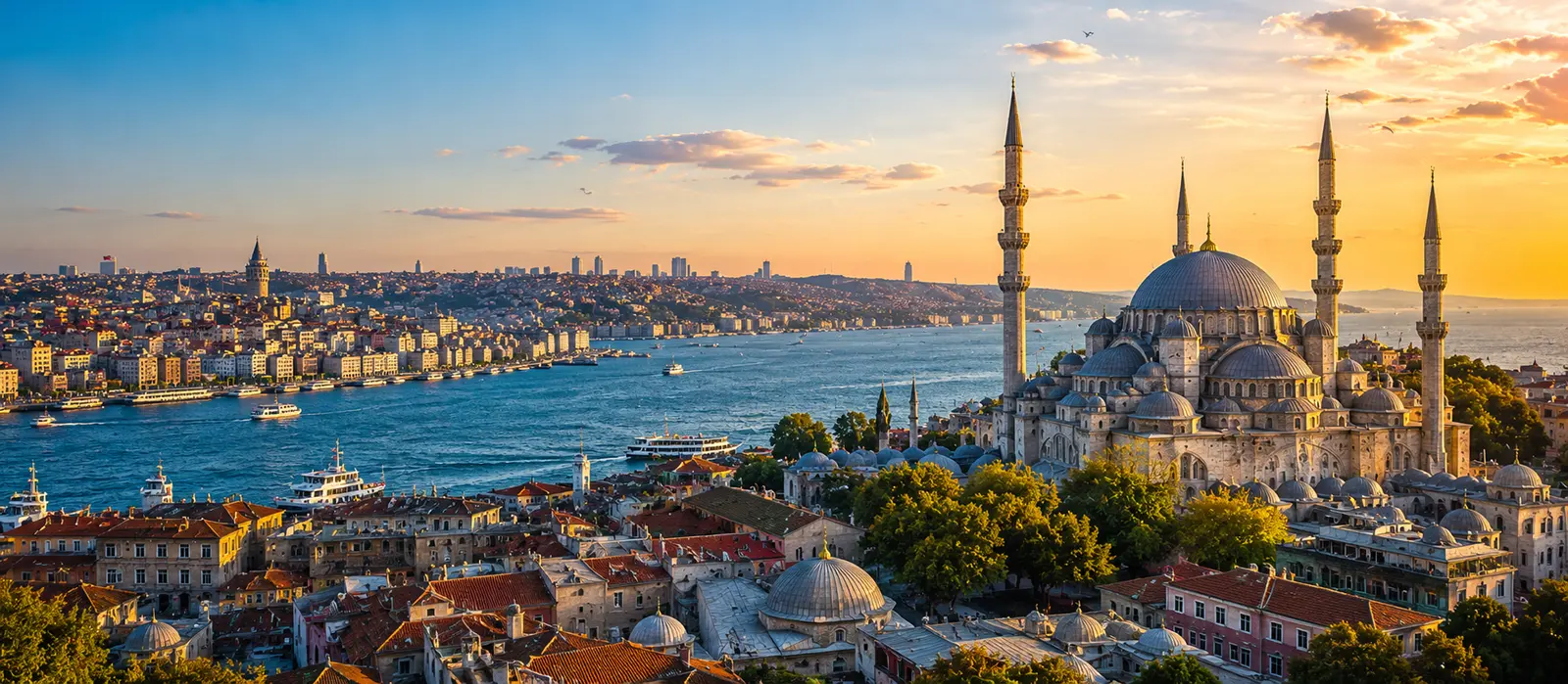
Can Ignoring Ferry Routes Limit Your Experience?
Without ferries, Istanbul becomes a map of obstacles instead of a network of shores.
Yes. Ignoring ferry routes can limit an Istanbul trip because ferries connect neighborhood centers, reveal the city’s geography, and turn necessary movement into one of its most characteristic daily experiences.
A land-only itinerary still reaches many famous places. It also makes the Bosphorus and Golden Horn feel like barriers to route around rather than working parts of the city.
Without ferries, Istanbul becomes a map of obstacles instead of a network of shores.
Smart Tip
Before finalizing a cross-city day, compare complete journeys rather than vehicle speed: walking to the terminal, waiting, sailing, and onward transport. If the ferry route fits, save the return alternatives too. A good water crossing should simplify the day or enrich it—preferably both.
Ferries change the mental map of Istanbul
Road maps emphasize bridges, tunnels, traffic corridors, and long routes around water. Ferry maps emphasize shores facing one another.
Kadıköy becomes naturally related to Karaköy, Eminönü, Beşiktaş, and Kabataş. Üsküdar becomes a practical counterpart to Eminönü and Karaköy. Smaller Bosphorus and Golden Horn services create additional relationships that are easy to overlook when planning only by metro or car.
Water creates a shoreline network effect
A useful ferry does not merely connect two piers. It connects the walking areas, tram lines, metros, buses, markets, attractions, cafés, and neighborhoods around those piers.
This creates a shoreline network effect. Learning one terminal can make several future journeys easier.
The value of the ferry lies not only in the crossing, but in the urban possibilities attached to both ends.
Europe and Asia become ordinary parts of one day
Without ferries, crossing continents may sound like a special excursion requiring a major block of planning. With a useful commuter route, it can become a natural transition between lunch, a market, a museum, an evening walk, or the journey back to the hotel.
This changes the Asian side from an optional add-on into part of the metropolitan center. It also prevents the European side from being treated as one continuous tourist district.
The symbolic crossing remains powerful, but daily use makes it understandable.
The skyline becomes a relationship rather than a backdrop
From street level, monuments appear one at a time. From the water, hills, mosque silhouettes, towers, palaces, bridges, ports, modern buildings, and residential slopes enter the same frame.
The ferry shows why a landmark stands where it does and how separate districts face one another. The historic peninsula gains a shoreline; Üsküdar gains a position relative to it; Galata becomes part of a larger vertical composition.
A viewpoint offers a fixed image. A crossing continuously rearranges the image.
| Ferry route type | What it connects | What it reveals | Planning caution |
|---|---|---|---|
| Short cross-Bosphorus line | Major European and Asian centers | How two continents share one daily rhythm | Terminal access may decide the best pairing |
| Golden Horn line | Waterfront districts along the inlet | Industrial, residential, and historic layers | Frequency may be lower than core crossings |
| Bosphorus local line | Northern and cross-shore neighborhoods | How density and shoreline character change | Some services are directional or time-specific |
| Princes’ Islands line | Mainland terminals and the islands | A different metropolitan scale and pace | The journey requires a larger day block |
| Bosphorus tour | A planned scenic sequence | Shoreline history and long views | It serves a different purpose from commuting |
Neighborhood pairing becomes more intelligent
A visitor planning only by attraction names may place Kadıköy after Sultanahmet because both are famous, then return by an indirect land route. Ferry awareness suggests a more coherent sequence through a nearby pier.
The same principle applies beyond the most familiar crossing. A route can link a waterfront walk to another shore, connect the Golden Horn with Üsküdar, or make a Bosphorus neighborhood practical from an unexpected terminal.
Planning by pier catchment—what lies within a comfortable walk or one connection—often produces calmer days than planning by isolated landmarks.
Transport time can become recovery time
Road travel often demands continuous attention to traffic, turns, stops, and congestion. A ferry gives the passenger a defined interval with seating, air, changing light, and fewer navigation decisions.
That interval can restore energy between dense neighborhoods. The traveler can review the next route, drink tea, sit quietly, or simply stop processing street-level information.
The benefit is not only emotional. Better-rested visitors make clearer decisions after disembarking.
A public ferry shows ordinary life inside the view
On a commuter service, residents travel to work, school, appointments, shopping, and home. Some read, talk, rest, drink tea, watch gulls, or look at a skyline they have crossed many times.
The visitor sees the same water as a major attraction while participating in ordinary transport. Those meanings coexist without requiring a staged cultural experience.
Ignoring ferries removes one of the simplest places where tourism and daily life occupy the same seats.
The ferry introduces Istanbul’s daily rhythm
Terminals become intense before departures and relax after boarding. Morning passengers differ from weekend leisure crowds. Evening crossings collect the light, fatigue, and social plans of the city at once.
Schedules reveal which connections serve commuting, which support daytime movement, and which require deliberate timing. A route with limited departures behaves differently from a frequent central shuttle.
The timetable is therefore not a technical detail added after the itinerary. It helps explain what kind of route the city needs.
Ignoring timetables can create the opposite problem
Romanticizing ferries without checking them is as limiting as ignoring them. Some lines run frequently; others have wider gaps, weekday-only sailings, seasonal patterns, or different weekend and holiday service.
A traveler who arrives just after a limited departure may lose more time than a metro alternative would require. A late return can also become awkward if the final useful sailing no longer fits the evening plan.
Use the operator’s current timetable and verify the exact pier, direction, date, and return—not a screenshot saved months earlier.
Weather changes comfort and reliability
Wind, fog, storms, and sea conditions can affect exposed decks, passenger comfort, and occasionally service. A beautiful crossing in mild weather can feel very different in cold wind or heavy rain.
Carry the layer the waterfront requires, not only what inland streets suggest. On uncertain days, keep a metro, Marmaray, bus, or alternative ferry route available.
Flexible planning respects water transport as a real system rather than a guaranteed scenic performance.
The pier is not always beside the final destination
A ferry can be efficient terminal to terminal but inconvenient door to door. The hotel may sit uphill, the attraction may require another tram, or the desired neighborhood may stretch far beyond the waterfront.
Compare complete journeys. Include the walk to the pier, waiting time, boarding, sailing, exit, hill, and onward connection. Also include the quality of that time: a slightly longer ferry journey may be more comfortable than a compressed transfer.
Neither duration nor scenery should be the only measure.
Marmaray and ferries explain different versions of crossing
Marmaray moves beneath the Bosphorus and can provide a fast, high-capacity link within the rail network. A ferry moves across the visible water and connects through shoreline terminals.
The rail route is often stronger when time, weather, or onward metro integration dominates. The ferry is often stronger when the pier locations fit, rest matters, or the crossing itself contributes to the day.
Knowing both systems prevents loyalty to one transport mode from becoming inefficient.
Public ferries and sightseeing cruises are not substitutes
A local ferry is designed around transport demand. A Bosphorus tour is designed to create a longer scenic sequence. Both use the same water but answer different questions.
The commuter crossing shows how districts connect. The tour shows how shoreline layers unfold over distance. A visitor may value both, one, or neither on a short trip.
Calling every boat ride “a Bosphorus cruise” hides the practical network that residents use.
Water travel changes the emotional pace of the day
A ferry departure creates a clean transition: one shore recedes, open water interrupts the street, and another shore approaches. The visitor has time to finish one neighborhood before entering the next.
Underground and road transfers often preserve urgency. Water can break it. That pause helps separate memories and prevents several districts from blending into one long movement.
This emotional structure is easy to lose in an itinerary built only around fastest arrival estimates.
Sunset can improve the crossing and complicate the plan
Evening light makes the ferry memorable, but planning only for the image can create crowding, missed onward connections, or an inconvenient return from the wrong terminal.
Choose a crossing that already serves the day’s geography, then consider whether its timing approaches sunset. The photograph should strengthen a useful route rather than force a weak one.
Cloud, season, and skyline orientation will change the result. The transport value should survive when the sunset does not.
Small onboard rituals become part of the city
Tea, a simple snack, a seat by the window, the sound of docking, and the movement of gulls can become memorable because they occur within public transport rather than beside it.
Do not force the ritual on a very short or crowded crossing. Board first, respect passenger flow, keep aisles and doors clear, and decide whether there is enough time to buy and finish anything comfortably.
The experience works best when it follows the route instead of delaying it.
| Journey priority | Ferry advantage | Possible limitation | Useful comparison |
|---|---|---|---|
| Fast cross-continental transfer | Direct when both destinations are near piers | Waiting and pier access can add time | Marmaray or metro connection |
| Neighborhood exploration | Creates natural shore-to-shore pairing | The final walk may include hills | Complete door-to-door route |
| Rest between dense areas | Offers seating, air, and visual space | Peak sailings may be crowded | Travel quality, not minutes alone |
| Long shoreline understanding | Reveals changing Bosphorus geography | Limited lines require timetable discipline | Local long line or formal tour |
| Late or uncertain return | May provide a pleasant final transition | Frequency can fall or service can end | Rail and bus backup |
Use six checks before building a day around a ferry
- Piers: Confirm the exact departure and arrival terminals, not only the district names.
- Schedule: Check the current date, direction, weekday, weekend, and holiday pattern.
- Access: Count walking, hills, terminal entry, and onward transport at both ends.
- Purpose: Decide whether the route serves speed, scenery, rest, neighborhood pairing, or several at once.
- Return: Save the last useful sailing and at least one land-based alternative.
- Weather: Recheck service and comfort conditions when wind, fog, or storms are possible.
A ferry route can become the spine of the day
Instead of adding a ferry after attractions are selected, begin with a useful crossing and build neighborhoods around both terminals. This prevents unnecessary backtracking and gives the transition a clear role.
The day may start in the historic peninsula, cross to Üsküdar, continue through the Asian side, and return by another line or rail route. Another day may use the Golden Horn service to connect waterfront districts that seem fragmented on a road map.
The route becomes structure rather than decoration.
Ignoring ferries removes a layer of Istanbul
Ferries are not mandatory for every journey, and choosing them blindly can waste time. Yet ignoring them entirely removes practical links, shared public life, shoreline perspective, cross-continental normality, and one of the city’s most effective recovery spaces.
The strongest itinerary compares water and land for each relevant journey, then chooses according to the entire day.
Istanbul becomes easier to understand when the water is treated not as the space between places, but as one of the ways those places belong together.
Did You Know?
The official Şehir Hatları timetable groups services into inner-Istanbul crossings, other Bosphorus lines, Princes’ Islands routes, and Bosphorus tours. The network is broader than the familiar Kadıköy–Eminönü or Üsküdar–Eminönü crossings many first-time visitors notice.
Jean Mustafa Kowalski Nakamurason Hernández Obromoviç
Always Local
“I ignored the ferries because I wanted to experience authentic Istanbul traffic. Three hours later I had understood one bumper, two tunnels, and the moral philosophy of brake lights. On the return I took the boat and discovered that the city had been displaying both continents the entire time.”
Who is this guy?