
How Do Hills Change the Way You Explore Istanbul?
In Istanbul, direction can matter more than distance.
Istanbul's hills change exploration by making direction, elevation, and energy as important as distance. A route that looks short on a flat map may contain a steep climb, steps, uneven paving, or several smaller rises. The same street can feel effortless toward the waterfront and surprisingly demanding on the return.
This does more than slow walking. Hills influence which neighborhood you visit first, how long you remain there, whether you arrive tired, where views suddenly appear, and which transport connection becomes valuable. In Istanbul, an efficient route does not merely connect points. It manages height.
Why Does Direction Matter So Much?
Most city maps train the eye to compare horizontal distance. Istanbul asks for a second reading: which point is higher? That question can completely change the meaning of a route. A hotel near the water and an attraction farther inland may appear close, yet the walk between them can involve a sustained ascent. Reverse the journey and the physical experience changes even though the map line remains identical.
This is directional asymmetry. The mechanism explains why a traveler may describe a morning walk as pleasant and the return as exhausting, or why two people following the same itinerary in opposite order report different levels of fatigue. Distance is symmetrical. Effort is not.
Direction also affects attention. Walking uphill narrows awareness toward footing, breathing, and the next section of pavement. Walking downhill often opens the gaze toward roofs, water, minarets, and the street ahead. One direction makes the body more present; the other may make the city more visible.
How Do Hills Change the Real Size of a Neighborhood?
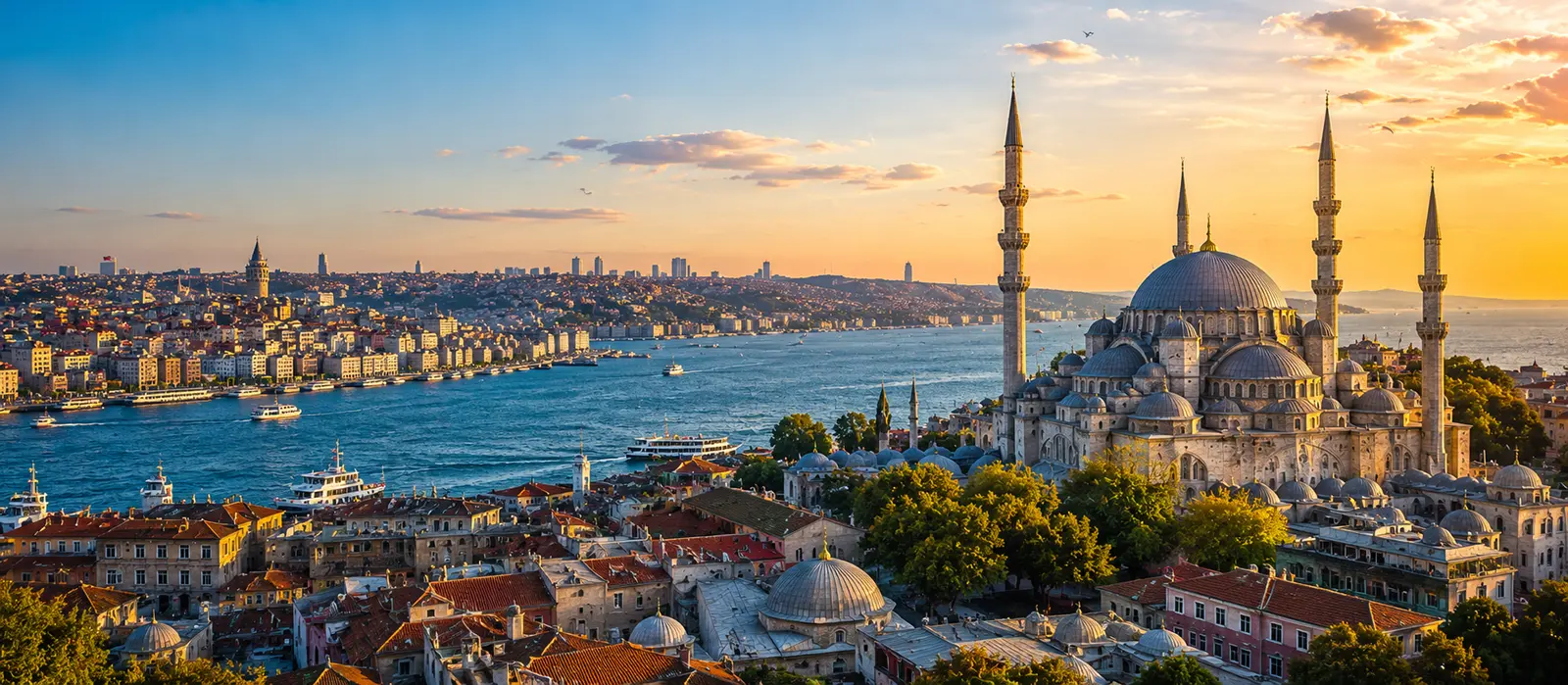
A compact neighborhood can feel much larger when its useful places sit on different levels. Karaköy and the upper parts of Beyoğlu are close in plan view, but the rise between waterfront and hilltop changes how casually visitors move between them. Similar vertical relationships appear around Beşiktaş and Yıldız, the Bosphorus shoreline and inland ridges, or Üsküdar's waterfront and higher residential streets.
The effect accumulates. One climb may be enjoyable. A second still feels manageable. By the fourth, a visitor may begin skipping courtyards, cafés, side streets, or viewpoints that looked easy when the day began. The hill has not only consumed physical energy; it has reduced curiosity. Fatigue edits the itinerary before the traveler consciously does.
| Map impression | What elevation adds | Better planning response |
|---|---|---|
| Two places are close | A steep rise or long staircase | Check elevation before committing to the walk |
| The route is identical both ways | One direction may be far more demanding | Use transport uphill and walk downhill when suitable |
| Five stops fit into one district | Repeated climbs multiply fatigue | Order stops by level, not only proximity |
| A viewpoint is nearby | The final approach may be the hardest section | Protect time and energy for the ascent |
| The hotel is centrally located | Daily uphill returns can become costly | Evaluate the last climb as part of the location |
Why Do Funiculars Matter Beyond Saving Time?
Funiculars are not merely short rail lines. They are pieces of vertical infrastructure: systems built to remove an elevation barrier that would otherwise separate districts or transport networks. Metro Istanbul currently lists the F1 line between Taksim and Kabataş and the F4 line between Boğaziçi University–Hisarüstü and Aşiyan. Their importance becomes clearer when the city is read in height rather than only in kilometers.
The F1 connection helps link the Kabataş waterfront with Taksim's higher level. The F4 connection links the Bosphorus shore at Aşiyan with Hisarüstü and the M6 metro connection above. Cable-car lines such as Maçka–Taşkışla and Eyüp–Pierre Loti perform a related spatial job in other settings. These systems do not simply move passengers forward. They compress a climb.
That compression can protect the rest of a day. A traveler may willingly walk the interesting streets after reaching the higher level but resent spending the same energy on a direct ascent beside traffic. Using a funicular is therefore not missing the city. It can preserve the energy required to notice it.
Smart Tip
When a day includes both a waterfront and a hilltop district, test the itinerary in reverse. If one version lets a funicular, metro, tram, or bus handle the major ascent and leaves the scenic direction for walking, it will often feel more coherent even when the listed attractions stay unchanged.
How Should Hills Change the Order of Your Day?
Begin by separating destinations into rough levels: waterfront, lower streets, mid-slope, and ridge or hilltop. The categories do not need precise elevation figures. Their purpose is to reveal repeated climbs. If the plan moves water–hill–water–hill, proximity may be creating a physically inefficient sequence.
A more comfortable day often starts high and descends gradually, or uses transport to regain height only once. For example, a traveler can reach an upper district by rail, explore its streets, then move downward toward the shore. This converts elevation into narrative: broad avenues become narrower streets, views open, sounds from the waterfront grow closer, and the day ends near a tram, ferry, or level promenade.
Morning can be better for an unavoidable climb because energy is fresh and summer heat may be lower. Later in the day, the same ascent can feel heavier after museums, queues, meals, and several hours on hard surfaces. Sunset planning needs special care. A viewpoint may be rewarding at the end of the day, but the climb required to reach it should not be discovered ten minutes before the light changes.
- Place demanding ascents early when the route cannot be reorganized.
- Group places by elevation so the day does not repeatedly surrender and regain the same height.
- Finish near useful transport when fatigue is most likely to influence decisions.
- Keep one optional stop so the itinerary can contract without feeling broken.
When Does a Hill Become Part of the Experience?
Not every slope should be optimized away. Hills create many of Istanbul's strongest spatial reveals. A narrow street may suddenly frame the Bosphorus. A gap between buildings may expose a dome or a line of ferries below. Descending toward the water produces a sense of arrival that a direct vehicle drop-off cannot reproduce.
The hill also explains neighborhood character. Upper streets may feel residential and self-contained, while lower streets gather transport, commerce, visitors, and waterfront movement. Walking between those levels reveals how a district organizes daily life. The slope is not empty space between two attractions; it is evidence of how the city adapted to terrain.
There is a rhythm to this: effort, pause, view, descent. A small tea stop halfway up may become more memorable because it answers a physical need. A viewpoint feels earned because the approach prepared the eye for it. Elevation can turn movement into anticipation.
The useful distinction is between a meaningful hill and a wasteful climb. A meaningful hill contains streets, views, architecture, or neighborhood transitions you want to experience. A wasteful climb repeats ground, follows an unpleasant road, or consumes the energy needed for the destination itself. Good planning keeps the first and removes as much of the second as practical.
How Do Weather, Surfaces, and Crowds Change a Slope?
Gradient is only one component of difficulty. Heat increases the cost of exposed uphill walking. Rain can make stone, metal, painted surfaces, and steep descents less secure. Wind is often more noticeable near open ridges and waterfront approaches. Crowds can reduce the natural pace on stairs or narrow pavements, while luggage changes balance and makes every uneven section more demanding.
Footwear matters more here than it might in a flatter city. Shoes that feel acceptable in a museum can become uncomfortable during long descents because the foot repeatedly presses forward. Smooth soles may feel uncertain on wet stone. The route should also be judged for accessibility rather than merely steepness; steps, broken pavement, high curbs, and interrupted sidewalks may be the decisive barriers.
| Condition | How it changes a hill | Useful adjustment |
|---|---|---|
| Hot, sunny weather | Exposed ascents consume energy faster | Climb earlier or use transport for the steep section |
| Rain | Descending surfaces may become slippery | Choose gentler streets and allow more time |
| Luggage or stroller | Steps and uneven paving become major barriers | Verify accessible station exits and street continuity |
| End-of-day fatigue | A modest climb feels disproportionately difficult | End near rail, ferry, tram, or a practical pickup point |
Can Hills Improve the Way You Understand Istanbul?
Yes, because they make the city's layers visible. From the water, Istanbul can appear continuous. From a slope, it becomes a composition of levels: shore roads, ferry piers, retaining walls, stair streets, terraces, towers, ridges, and neighborhoods that face the same water from different heights.
Hills also challenge attraction-based planning. Two famous places may be close but awkward to connect, while an unplanned sequence of streets on one level may produce a richer hour. This encourages a neighborhood logic: explore what belongs naturally to the same terrain before crossing the city for the next name on a list.
The best response is neither to avoid every incline nor to treat exhaustion as authenticity. Use infrastructure for climbs that add little, walk slopes that reveal something, and remember that downhill today may become uphill tonight. Istanbul's hills shape more than the route. They shape pace, perception, appetite, timing, and the number of decisions a traveler still has the energy to make.
Did You Know?
Istanbul's funiculars are easiest to understand as vertical shortcuts. The F1 links Kabataş and Taksim, while the F4 links Aşiyan on the Bosphorus with Boğaziçi University–Hisarüstü above, turning steep elevation changes into transport connections.
Jean Mustafa Kowalski Nakamurason Hernández Obromoviç
Always Local
“In Istanbul, I never ask whether the hotel is close. I ask whether the hotel is above me and planning revenge.”
Who is this guy?